Wa Dictionary Home
Dictionary Database
Corpus of Wa Texts
Myanmar Minority Language Database
Resources
Interactive Tools
What's New
Search
Humanities Computing Lab
SOAS, University of London
|
|
Maps of the Greater Wa-speaking Area
Updated 2006-06-23
Note: some of these maps are large files (usually
labelled "Big!", with the size indicated in kilobytes) and should not be attempted
unless you have a fast connection and plenty of available memory.
After viewing a map, press your browser Back button to return here.
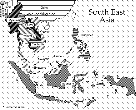
South East Asia regional maps showing language data
Chinese maps
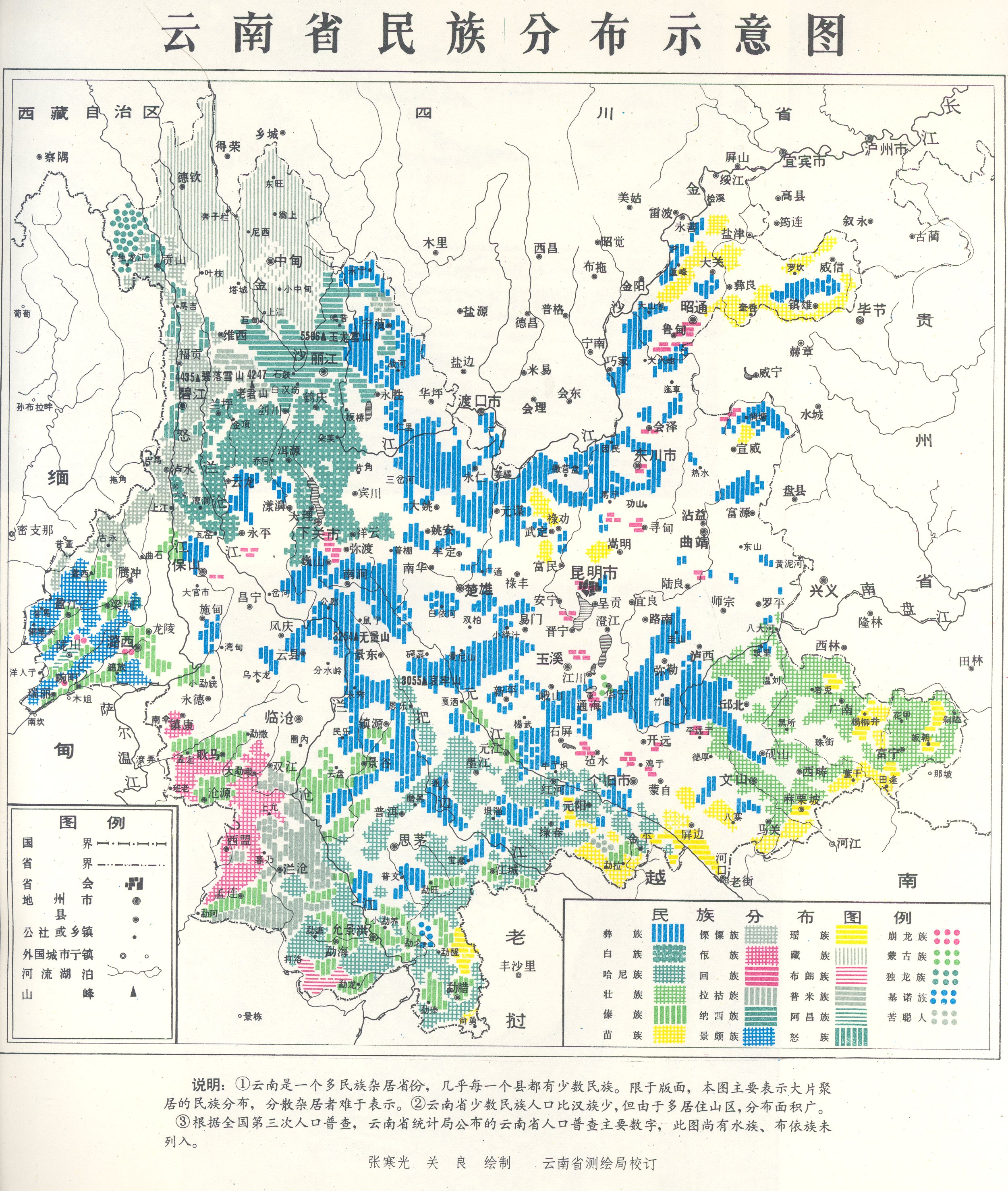
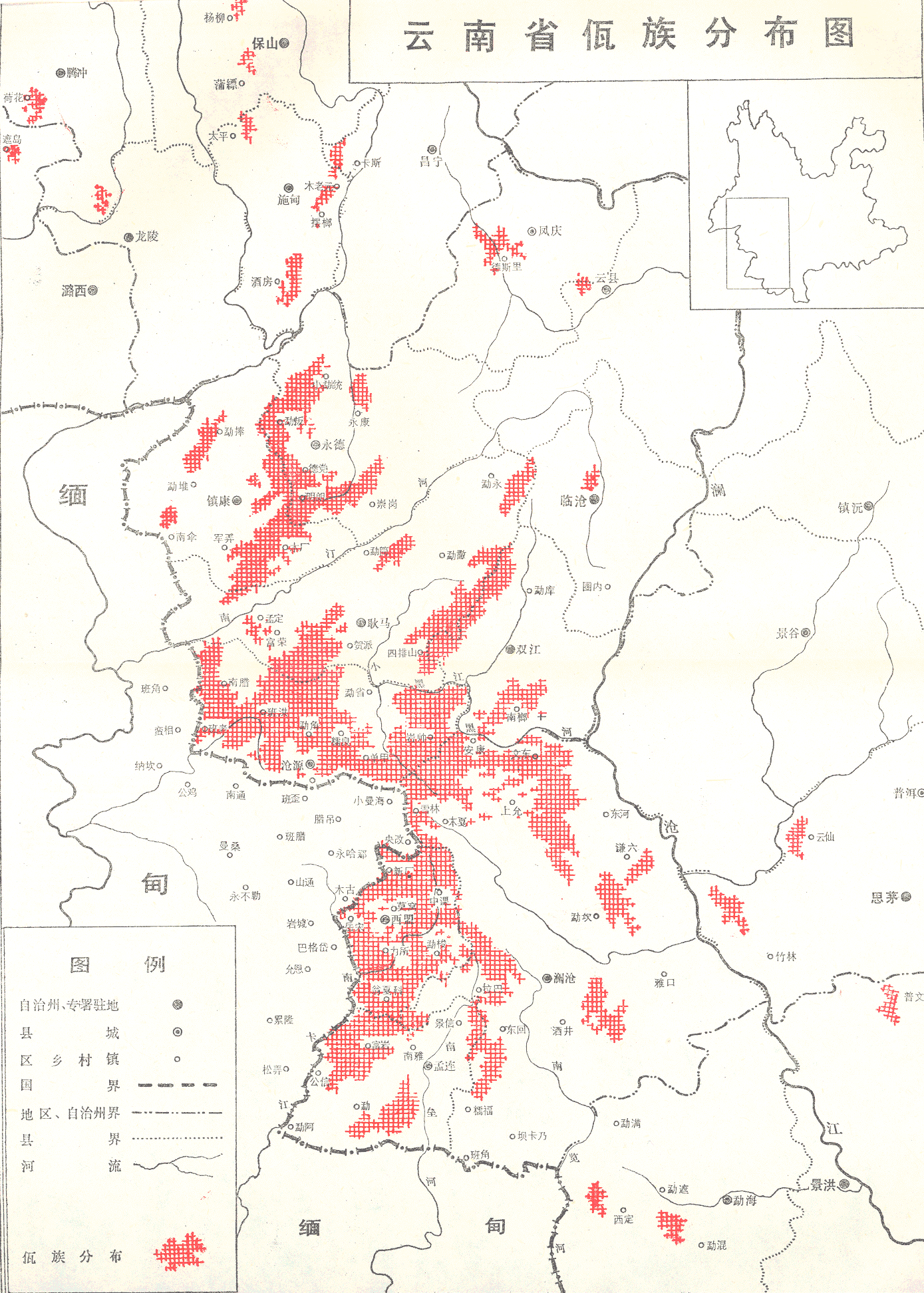
- Detailed map showing
distribution of minority nationalities in Yunnan, China. Wa speakers are indicated
by red "gingham" cross-hatching. (from Wazu shehui lishi diaocha,
Vol. 2, following title page) (JPEG, Big!- 1754KB)
- Detailed map showing
distribution of Wa speakers in Yunnan, China (from Wazu jianshi,
preceding p.1)
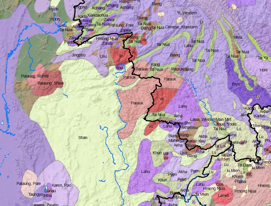
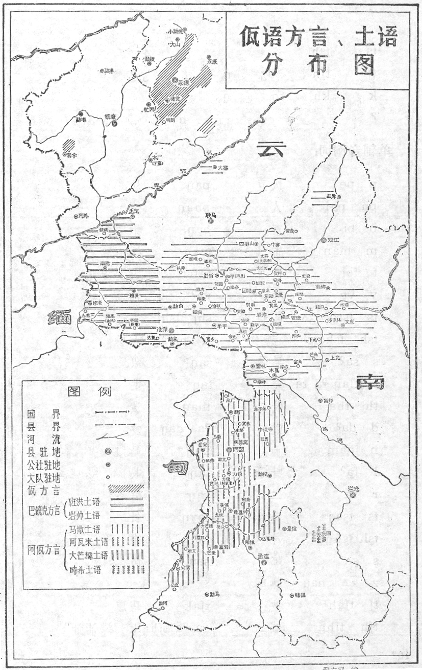
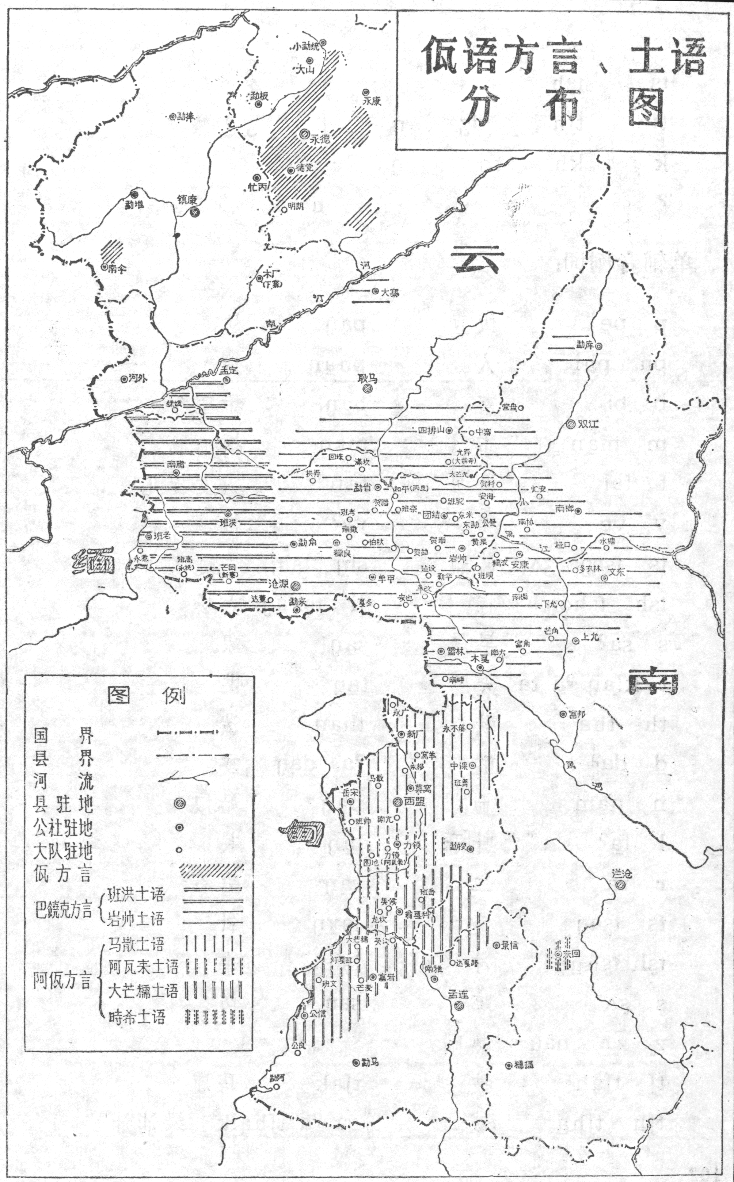
- Map showing three main dialect groupings of Wa speakers in Yunnan,
China, as well as additional sub-dialects. Smaller
300dpi version (785KB) and larger,
more readable, 600dpi version. (1589KB) The Ba Raog (Paraok) dialect group,
the basis for standard Wa, with approximately 180,000
speakers in 1980, is shown in the center with horizontal shadings;
the Va dialect group, with approximately 30,000 speakers in 1980,
is shown to the north, with diagonal shading; the Ava dialect group,
with approximately 60,000 speakers in 1980, is shown to the south,
with vertical shadings (from Wayu jianzhi, p.101).
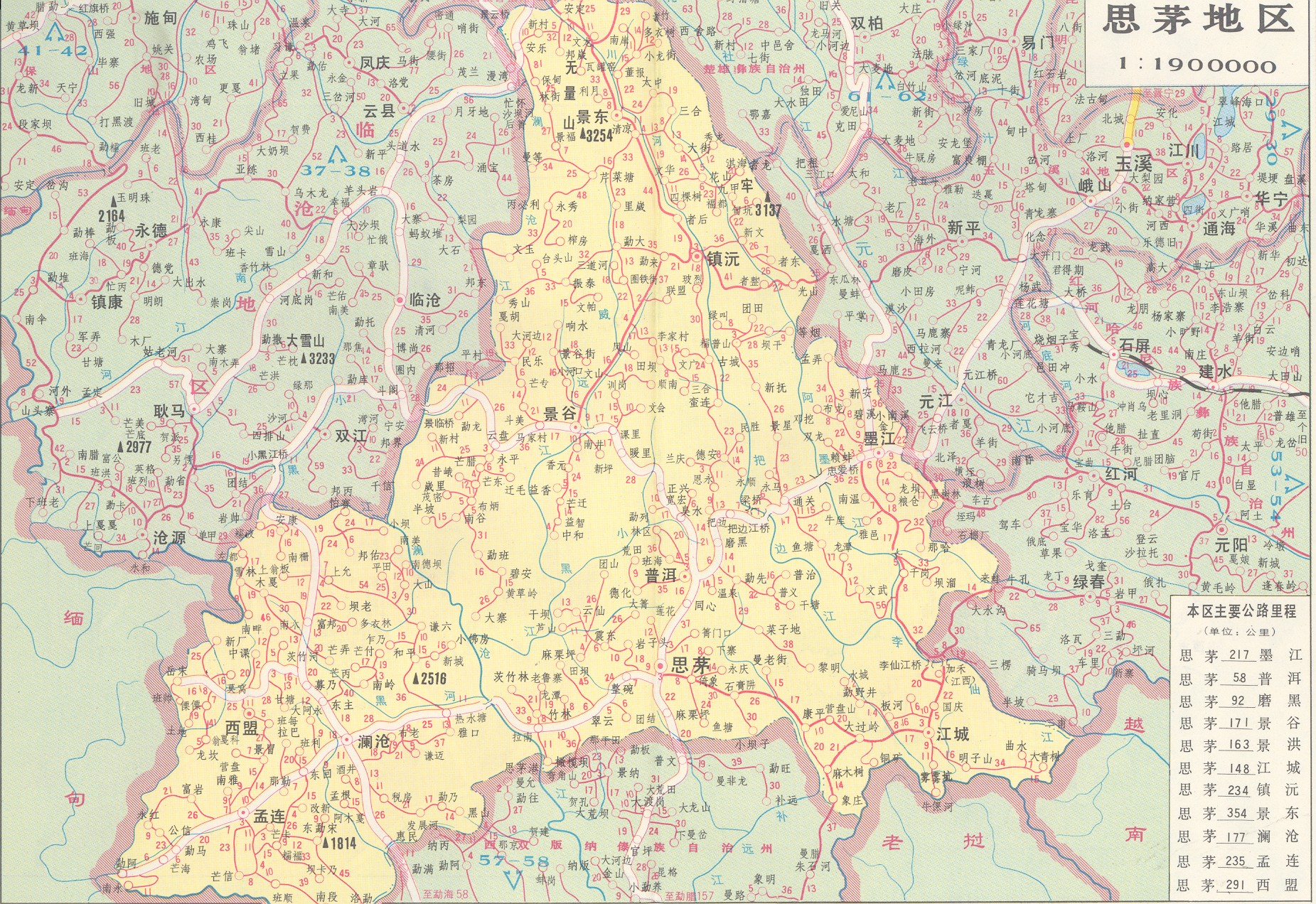
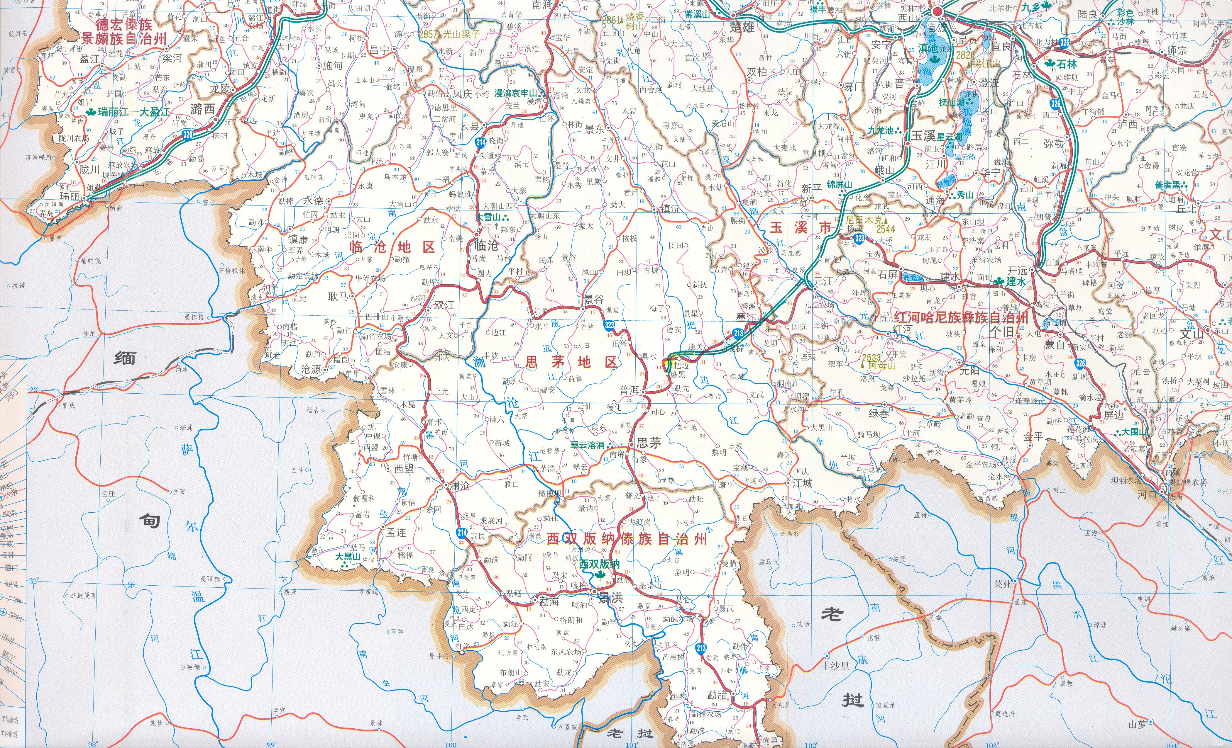
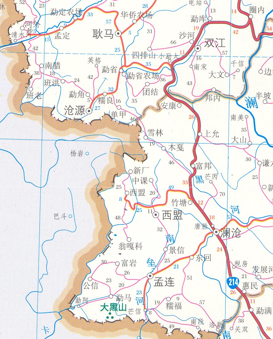
- Yunnansheng Jiaotong
Tuce, pp. 33-34, Simao Diqu (JPEG, Big!-1165KB)
(Chinese-language map of Simao prefecture, Yunnan, China from Atlas
of Yunnan Province, including Wa-speaking Menglian, Ximeng, and Lancang
counties)
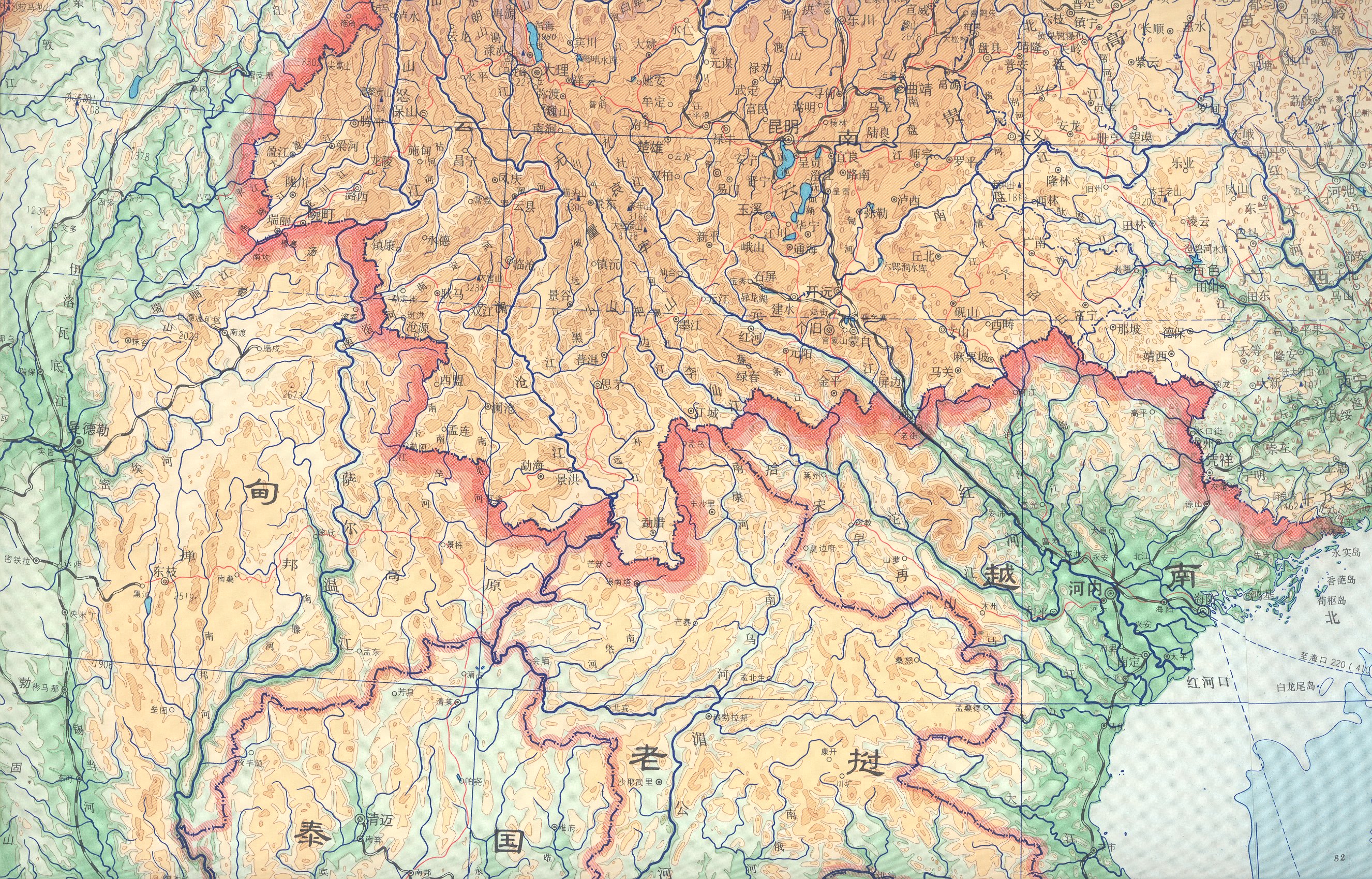
- Yunnansheng Jiaotongtu
(JPEG, Big!-3736KB)
(Chinese-language 2004 transportation map of Yunnan province, China, including
most of the province between Kunming and the Myanmar border. Or a
smaller portion
limited to the central Wa-speaking region (334KB).
Myanmar/Burmese Maps
- Small map of Shan State, Myanmar,
showing the traditional Wa-speaking areas of Myanmar to the northeast;
the areas of Wa immigration since 1999 in the southeast along the
border with Thailand and Laos; the United Wa State Army (UWSA) capital
at Pang Hsang (Pangsang on the map); and transportation links into
the Wa areas from the south. (JPEG, 155KB)
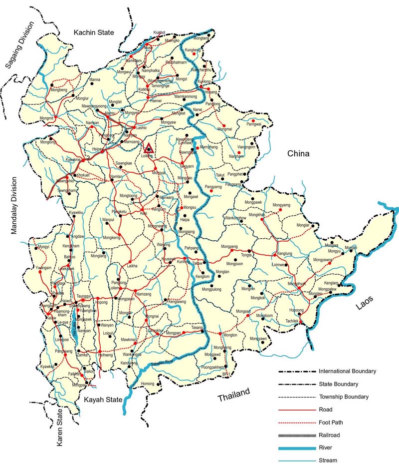
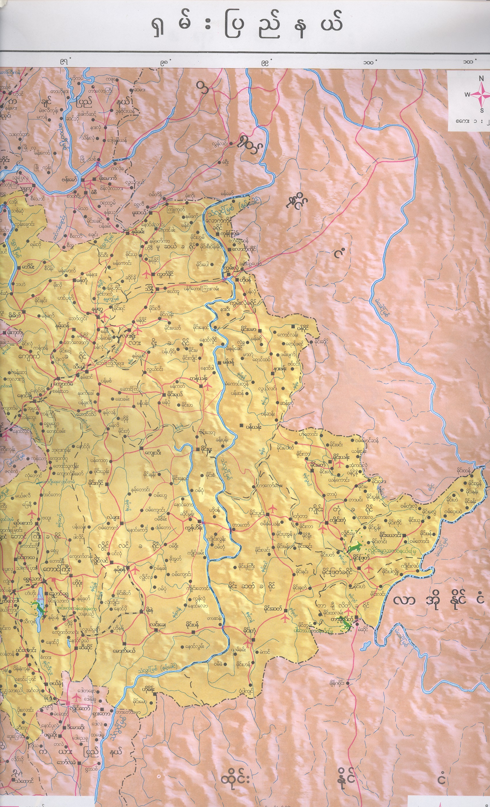
- Large,
detailed English-language map of Shan State, Myanmar (JPEG, Big!-1831KB)
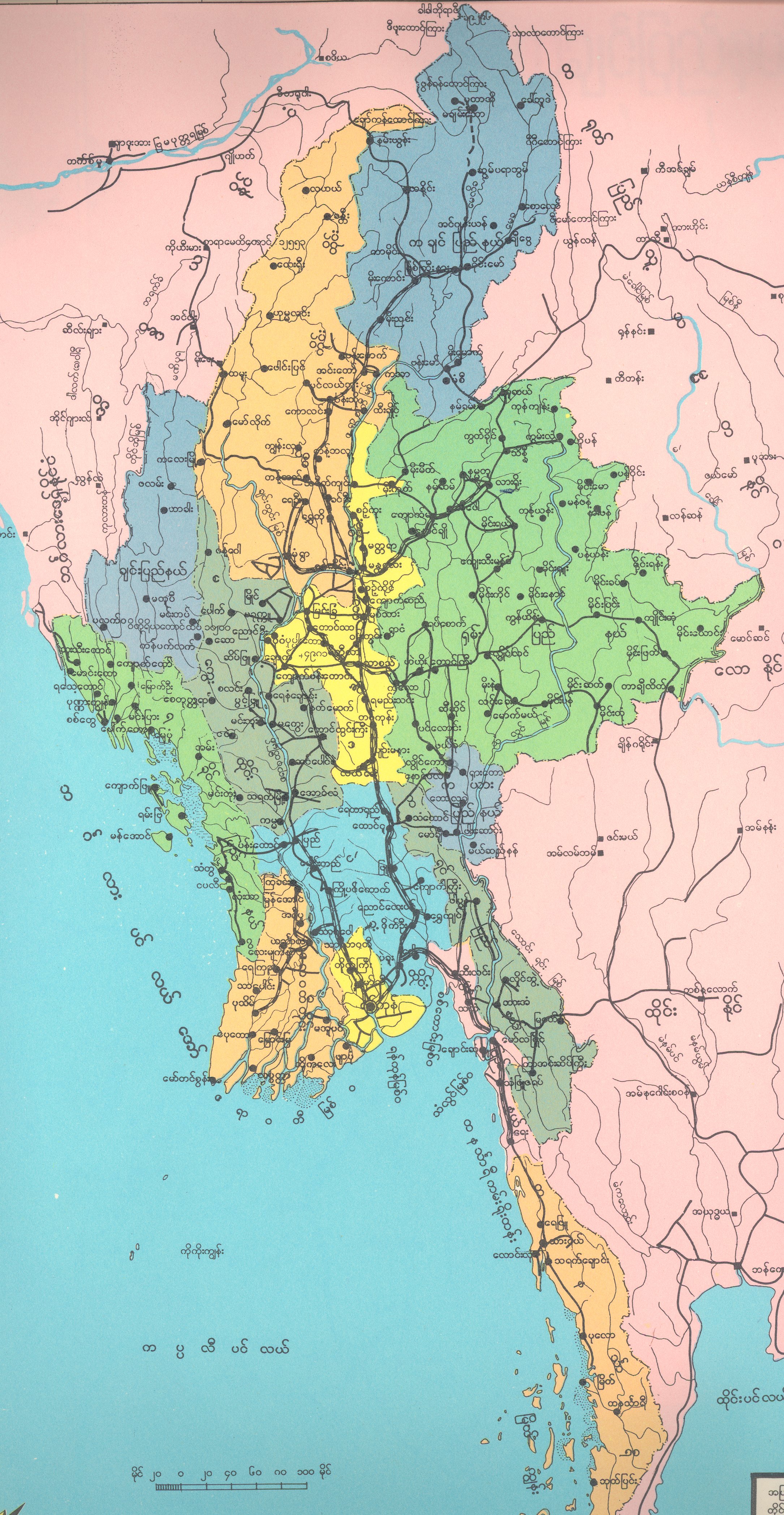
- Burmese-language map
of Myanmar (JPEG, Big!-2207KB)
- Burmese-language map of
Shan State, Myanmar (JPEG, Big!-2053KB)
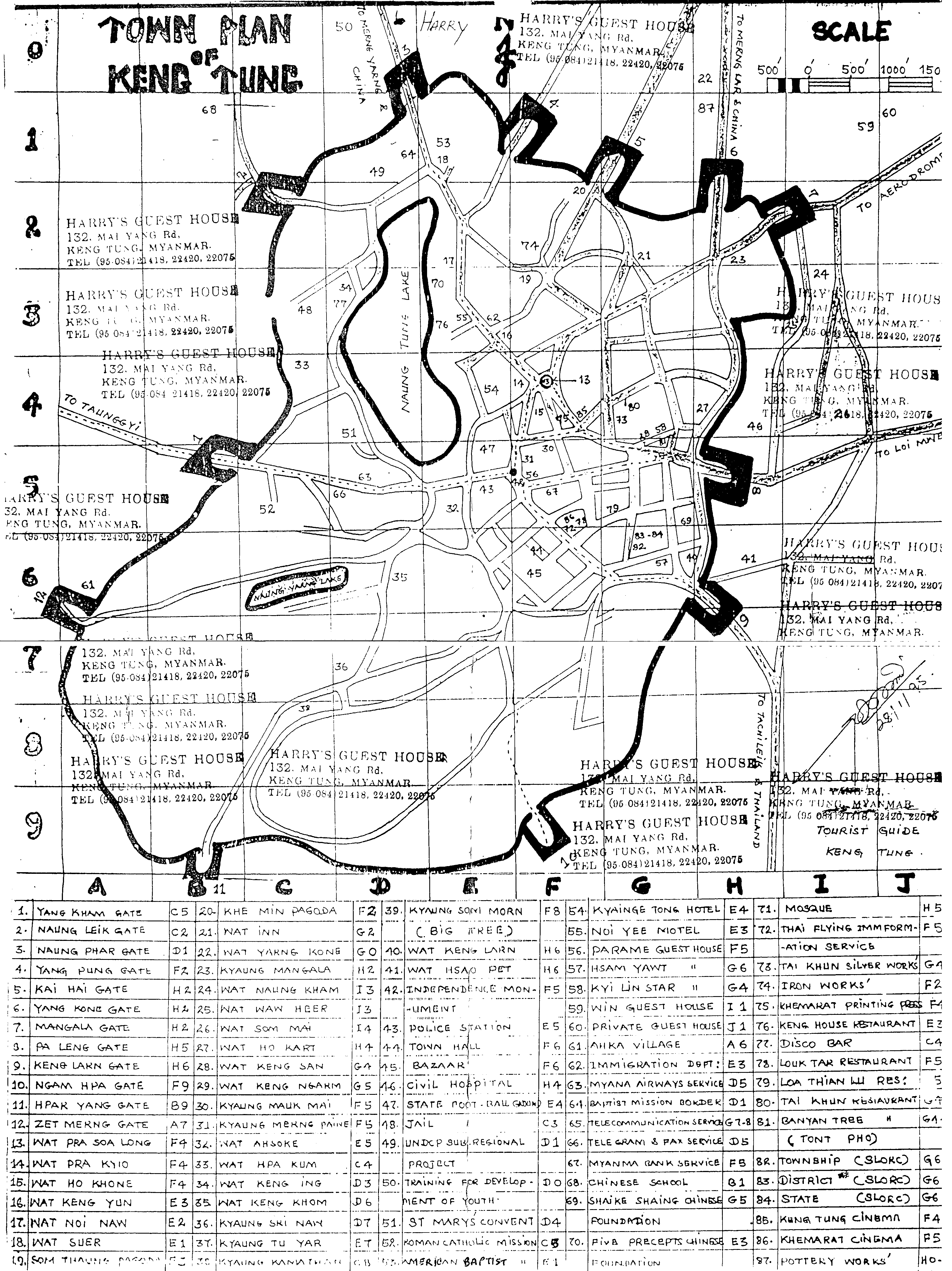
- One city map of
Kengtung, Shan State, Myanmar (GIF-469KB)
- Another city map of
Kengtung, Shan State, Myanmar (GIF-249KB)
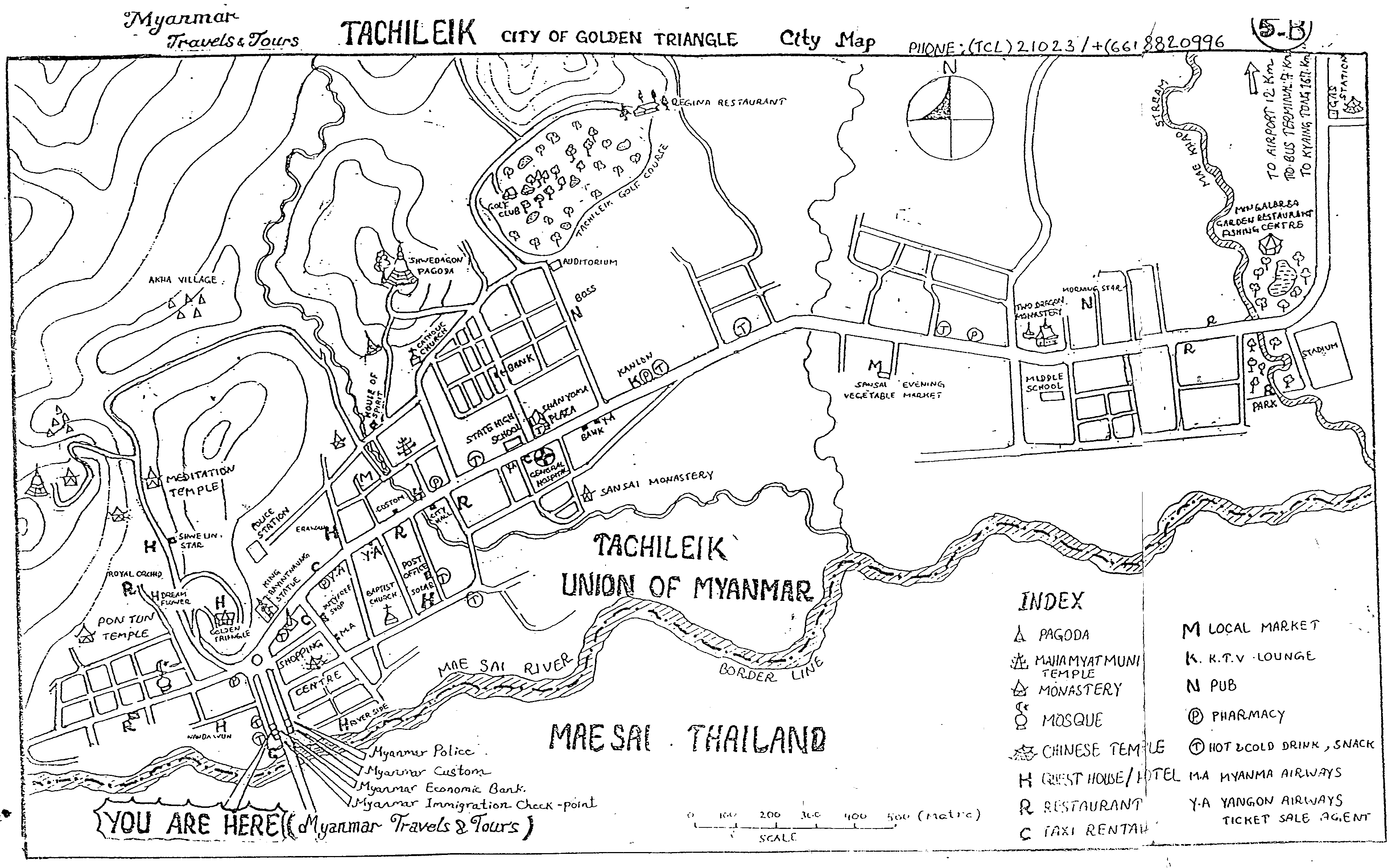
- City map of
Tachileik, Shan State, Myanmar (GIF-233KB)
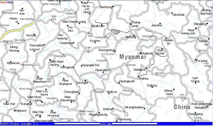
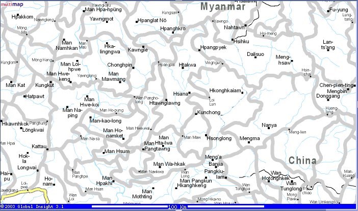
- Multimap.com map of northwest Wa territory (JPEG-91KB)
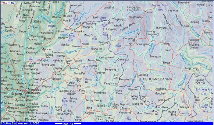
- Multimap.com map of southwest Wa territory (JPEG-91KB)
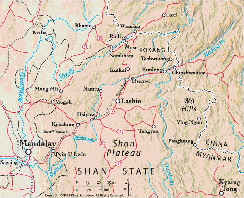
- Collins map of Wa territory (JPEG-119KB)
- Map of Northern Shan State, Myanmar, from www.travel-burma.net/bilder/maps (© 2001 Kurt Schroeder) (GIF-168KB)
- Map of north-south trade routes in Shan State, Myanmar (GIF-62KB)
- Maps and Appendices
from the Lahu National Development Organization book Unsettling Moves
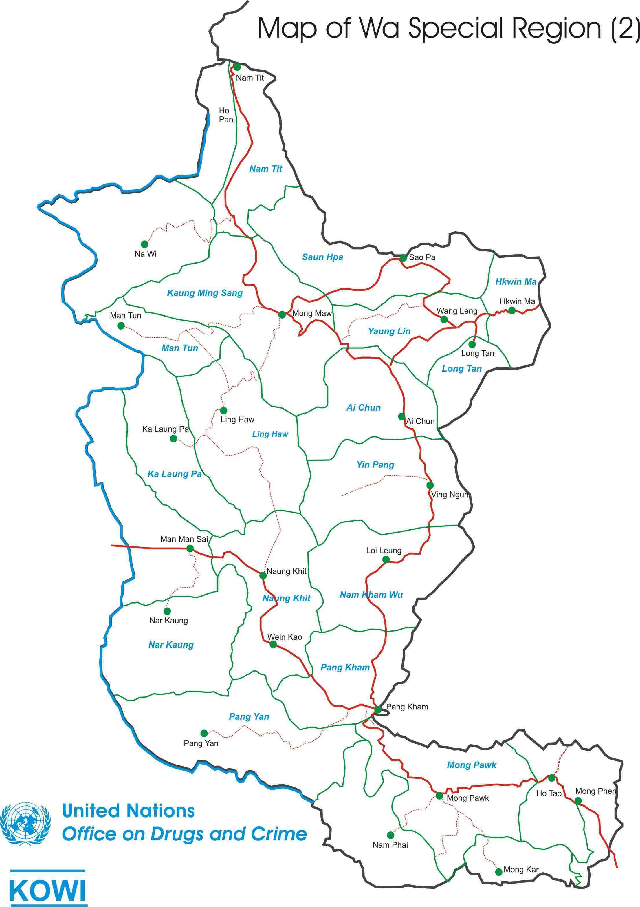
- UNODC map of Wa Special Region 2 (2006) (JPEG-247KB)
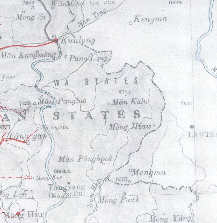
 British War Office 1944 map of Burma, "Wa States" area:
smaller area (JPEG-192KB)
larger area (JPEG, Big!-1173KB) British War Office 1944 map of Burma, "Wa States" area:
smaller area (JPEG-192KB)
larger area (JPEG, Big!-1173KB)
Maps showing topographical features
- Zhonghua Renmin Gongheguo Dixingtu
(JPEG, Big!-1995KB)
(Detail from Chinese-language topographic map of China and Northern
SE Asia, including the greater northern Mon-Khmer-speaking region)
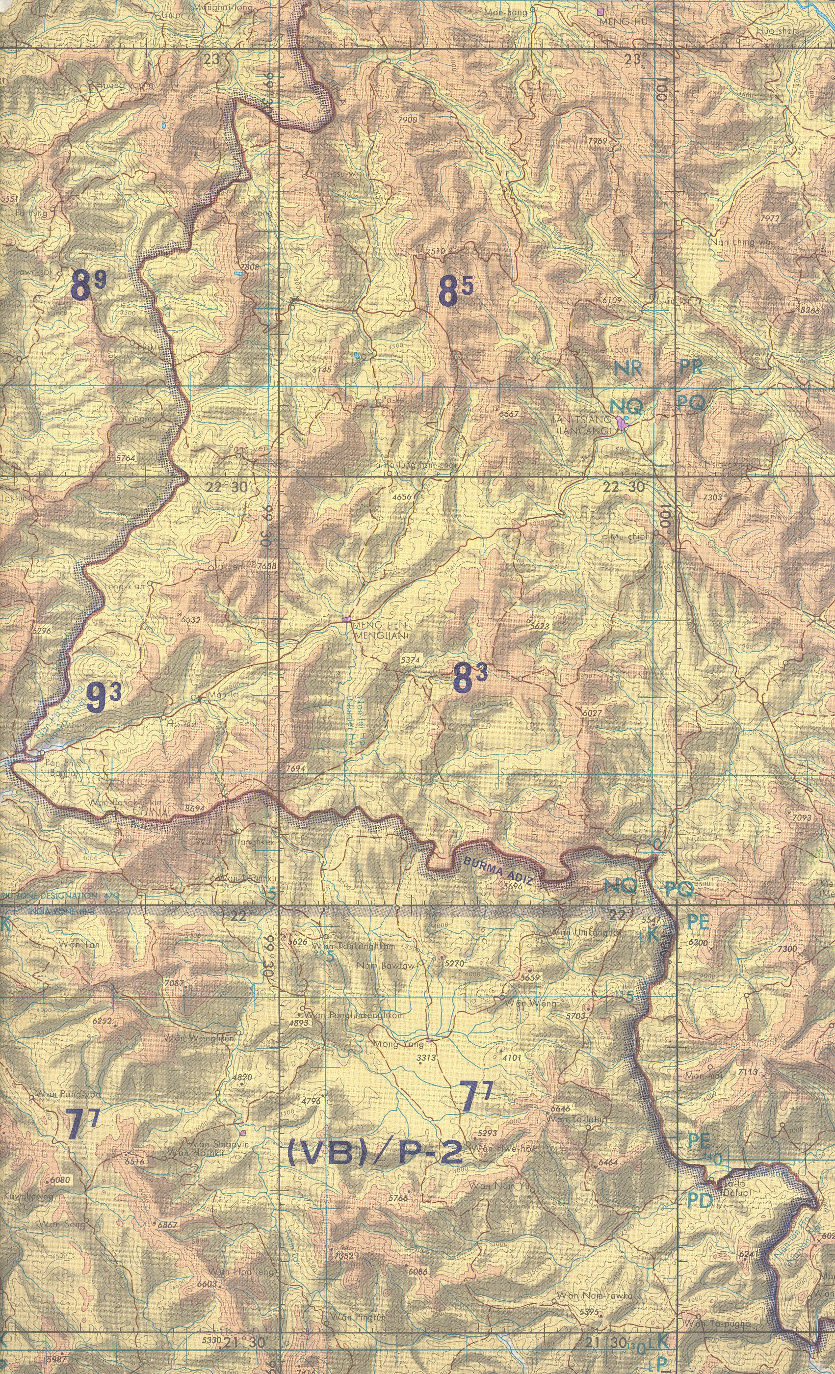
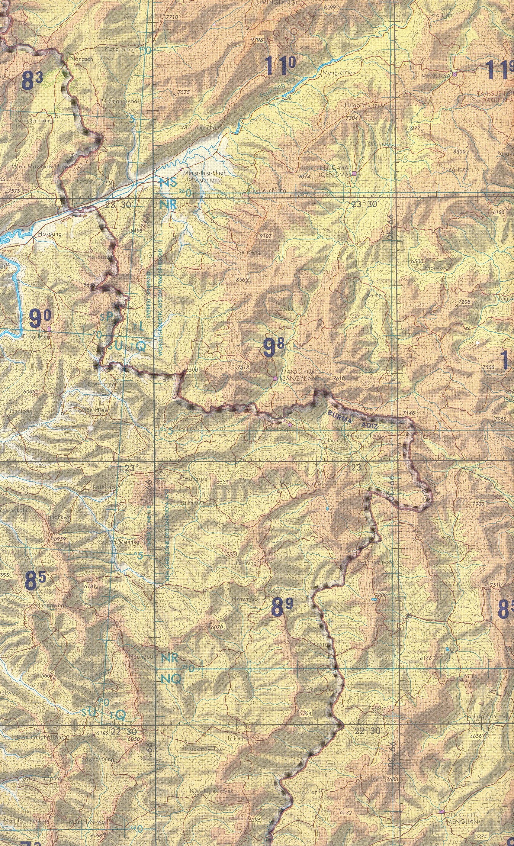
- Portions of pilotage chart for Myanmar-Yunnan area: southeast
Wa area, centered on Menglian, Yunnan, China (JPEG, 2439KB); and northwest
Wa area, centered on Cangyuan, Yunnan, China (JPEG, 2915KB) (TPC Series, J-10B, ca. 1970).
(2915KB)
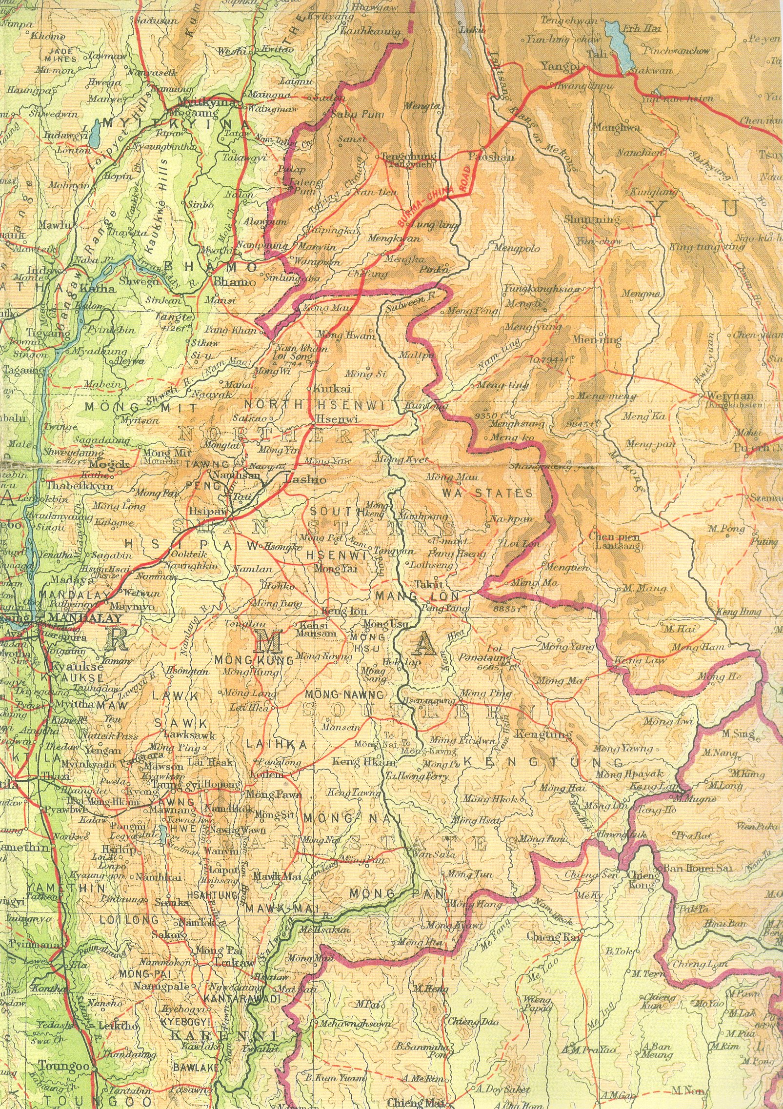
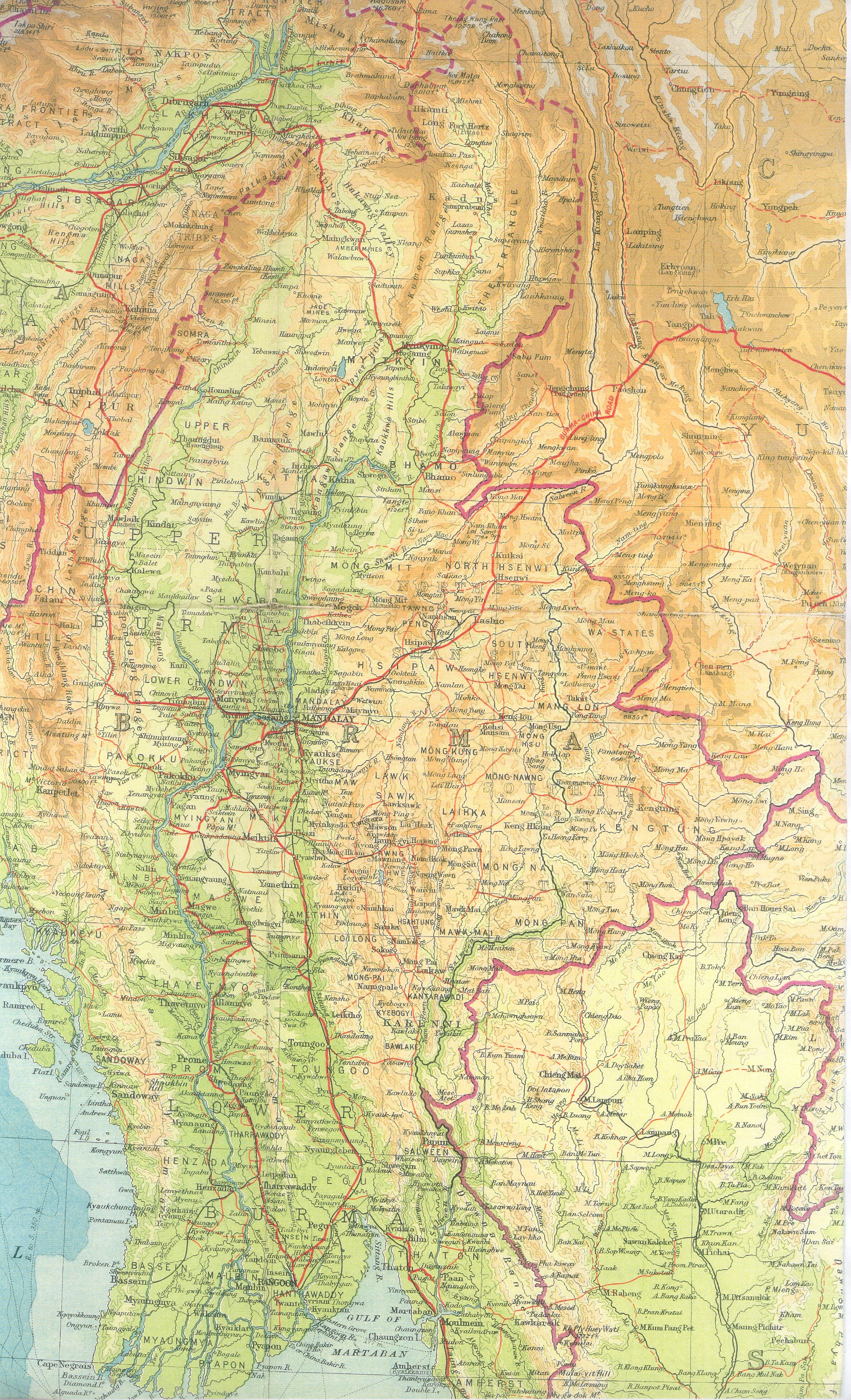
- Burma map, ca. 1940's
Shan States area (JPEG, Big!-1594KB)
eastern Burma and northwest Thailand (JPEG, Big!-2165KB)
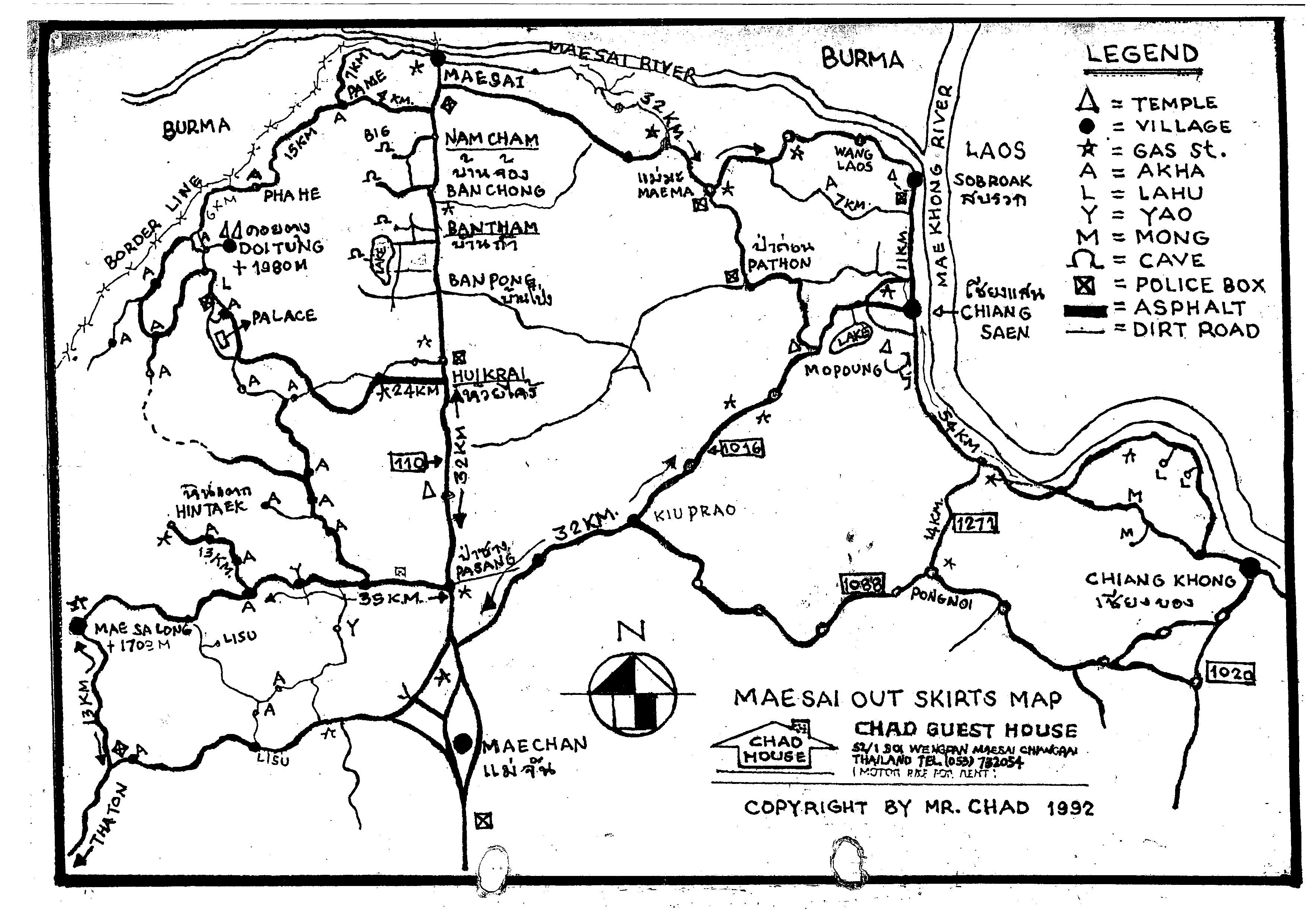
Other miscellaneous maps
|

.gif)